
Don't miss a second of summer!
Our #30DaysWild challenge will help you to connect with nature every single day across June. Sign up now to get a FREE pack of goodies, plus prompts and activities across the month to help you stay wild.


Gordon Train
Protect wildlife & wild places
Give Cumbrian nature your regular support by becoming a Cumbria Wildlife Trust member today.
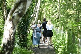
Take action for wildlife in Cumbria
Together with our members and volunteers, we're working to create a Cumbria that's rich in wildlife. Find out how you can get involved to give nature your support.


Latest Cumbria wildlife news
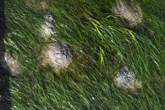
Donation will help restore Cumbria’s seagrass beds and boost carbon capture
We aim to revive vast seagrass beds in Walney Channel near Barrow, to help tackle climate crisis and bring back precious marine…
Eden Rivers Trust awarded £2.6m to break down the barriers to Eden’s rivers and natural heritage
Cold Springs Community Nature Reserve will benefit from new funding for Eden Rivers Trust's Access to Eden partnership
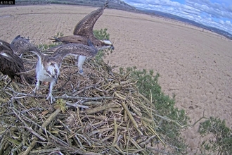
Dramatic return of Foulshaw ospreys
We're delighted to see Blue 35 and White YW back at Foulshaw Moss Nature Reserve


Practical things you can do this month to help wildlife


Sir David Attenborough © Tom Marshall
The Wildlife Trusts play a very important part in protecting our natural heritage. I would encourage anyone who cares about wildlife to join them.
Sir David Attenborough OM CH CVO CBE FRS, President Emeritus, The Wildlife Trusts
Join the conversation
Follow us on social


